Bike Groveland

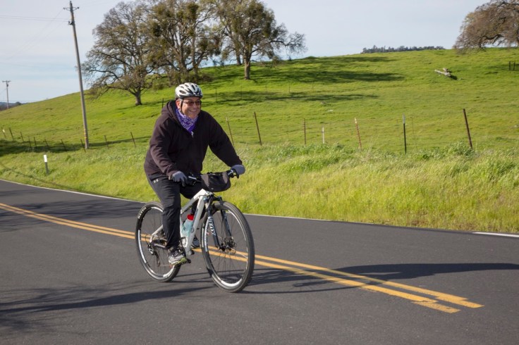
Groveland East or West

Submitted by Nikki Grimes, MLBC Board Member

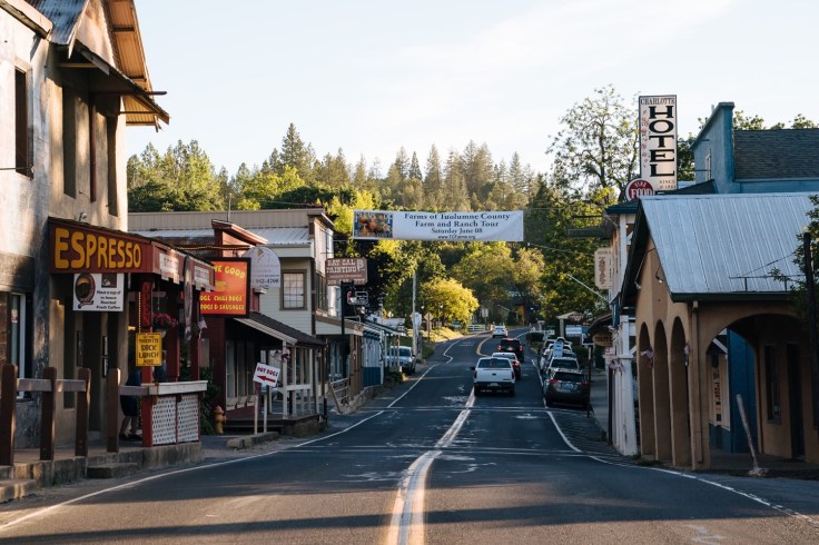
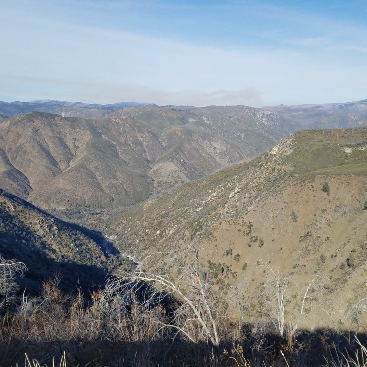
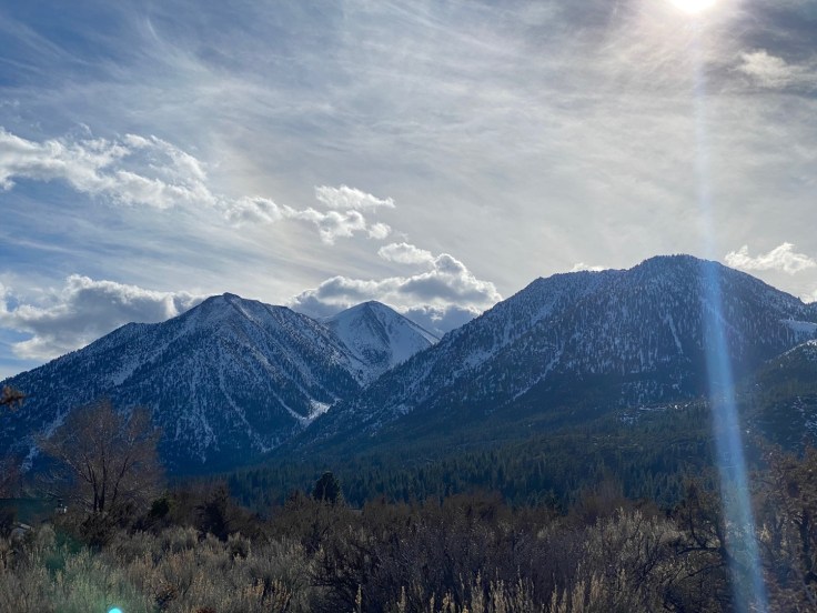
PHOTO COURTESY of Visit California-Mason Trinca

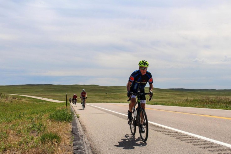
Starting at the Groveland Airport on Elderberry Way, just off Ferretti Road, there are two bike route choices…east or west.

The west route takes you through the community of Pine Mountain Lake. This route is safer, the busier, faster traffic is on Ferretti Road. That’s the good news.

The bad news is some of the climbs within the community are rather steep but then portions of Ferretti Road are steep too. If you know what’s coming, you can pick up speed on the downhill and gear down for the upcoming climb.

The great part of the west route are the views of Pine Mountain Lake!

Eventually, this route leads to Hwy 120 where you then head east. The highway climbs for a bit before a nice downhill, then another longer climb. It’s fairly level, not steep for a distance before the climb and drop pattern pops up again.

For the most part, the shoulders are wide on this stretch of Highway 120. Unfortunately, Caltrans recently repaved Highway 120 but then added rumble strips so cyclists need to be alert and avoid the rumble strips.

In winter, Caltrans uses decomposed granite on the road for icy road conditions. This, of course, does not stay on the road but accumulates in the rumble strips and shoulder so another hazard of which cyclists need to be aware.

Hwy 120 is “cleaner” in the late spring, summer and fall.

There are some side roads that parallel Hwy 120 which are great options. Old Hwy 120 is one of these. The first part is pleasant but then…a very steep climb back to Hwy 120. If you like challenges, you got it! Not my cup of tea but a good strength workout for not too long of a distance.

The other side roads are basically the same road with different names. East Sprague Road initially drops but the climb out isn’t too tough. It puts you alongside a creek, passes a few homes, and is quieter than the main highway although the road is rough. It changes names becoming Elmore, then Sutton, then Smith Station Road before returning to Hwy 120.

About seven miles down Hwy 120, you reach the eastern end of Ferretti Road. If you make a left turn, it takes you back to where you began. Total distance is just over 20 miles.

If you want more miles, don’t make that left turn and continue riding east on Hwy 120. Turn right into Groveland Ranger Station for a challenging climb up to The Pines Campground. At the Ranger Station, there are flush toilets and running water. The Ranger Station itself has a nice faucet for refilling water bottles but they are not open on weekends. (Unless they are closed due to COVID-19 pandemic). Continue on this road and it gets you back to Hwy 120 again.

A nice downhill takes you into the town of Buck Meadows. During spring through fall, the Lucky Buck Restaurant is open. Just a little further and you arrive at the Rim of the World, a vista point which also has some interesting history information down a short walkway. This is near where the Rim Fire started in 2013. There is a post asking you to take a picture and send it to #rimfire01 so the collectors of information can keep track of how the area is recovering after that blaze.

After a break here, one can either continue east all the way to the entrance of Yosemite National Park or turn around and follow Hwy 120 back to Ferretti Road and back to the airport where the ride began. If you turn around here, your total distance will be about 30 miles with about 2600’ of climbing.

https://ridewithgps.com/trips/53194732

SHOWCASE AREA FEEDBACK

San Joaquin County: Woodbridge/Lodi Area

The Lodi wine region has a high degree of existing infrastructure to support tourism from the Lodi Wine & Visitor’s Bureau and previous efforts undertaken by local community organization Bike Lodi, including efforts to map routes for visitors arriving to the community on bicycle. The roadway network surrounding the City of Lodi, including the unincorporated community of Woodbridge, serves several existing organized bicycle rides and events. While perhaps the best example locally of a community accommodating and seeking to attract bicycle tourism, the area still has several opportunities for further advancement and the potential to catalyze visits to other nearby regions in the study area

http://undefined

WHAT DO YOU THINK?

Are these the popular bike routes you like to ride currently?

What bike destinations or routes would you like to visit/ride to in the future?

Do you have Safety concerns within any Showcase Area?

Do you have any ideas for supportive amenities (signage, repair services, bike racks, etc) that would encourage bike riding in the Showcase Areas

Email me…at rob@calbike.org

Bike Valley Springs

Ride, Explore, and Dine in Valley Springs

November 30, 2020

If you’re experiencing cabin fever right now, you’re not alone. While travel options are restricted by the pandemic, there’s one way to get away, experience California, and stay COVID-safe: bicycle tourism. California’s Central Valley and Sierras have great bike rides that will give you a welcome break from daily life.

Great Bike Rides to Support Arts Education
Each spring Valley Springs holds an arts education fundraiser for Calaveras County K-12 public schools. See https://www.rideandwalk4art.com/ The three route options are available on this website, 25, 45, and 75. The routes start at Hogan Dam and wind around the Tri-Dam Lakes.
Hogan Dam Cameron Trail, New Hogan Lake
A multi-use trail starts at a small parking area north of the park headquarters. From there it travels above the water on crushed gravel and a number of interconnecting sections of road. The wide trail provides easy access to the Wrinkle Cove area, Fiddleneck area, Acorn Campground, and Oak Knoll Campground, and eventually ends at the Coyote Point Trail just north of Coyote Point. There’s intermittent to no shade so hike or bike either in the early mornings. Acorn Campground to Observation Point is a must family ride. No traffic road. Rides 4, 8, 10, miles.
Wrinkle Cove to Lime Creek, Valley Springs
Five miles out and back to practice road bike riding skills. The road is mostly flat with several short rolling hills. Light traffic, watch for deer during fall and summer. Parking at Wrinkle Cove
Sheldon Road, West of Valley Springs
My favorite ten-mile flat road and with expansive views of Sierras. My wife and I used this road to practice and prepare for bike tours in Europe and Asia. Parking is along fence lines just off Highway 26. Turn around at Escalon Belotta Road
Berkesey Lane, Rancho Calaveras
Absolutely the best two-mile road to learn how to ride a bike. This is my go-to bike road to teach grandchildren to ride a bike. Parking at either end of the road.
Gwin Mine Road, Paloma
A three-mile downhill ride to Middle Bar Road and a hilly bike ride back. This is a good ride for e-bikes.
South Hogan Road, Hogan Dam Reservoir
Below the Hogan Dam and across Calaveras River is a six-mile out and back rolling quiet rural road. The hill climbs out are challenging but, the ride back is much easier. There is very little traffic and beautiful views of Sierras.
Salt Springs and Hunt Road, Milton
The Salt Spring loop is as well known as any bike ride in the foothills partly or maybe mostly due to its use for the Copperopolis Road Race in the early spring. It’s a lovely ride with varied terrain, great scenery, and very little traffic, but the pavement is very rough. If you can set yourself up with 28C (1 1/8″) or wider tires, you’ll be fine. With 23C road tires, you may feel a bit beat up afterward.
Parking after Salt Springs Reservoir, along the road.

Great Bike Rides in the Sierras

Bike Riding in the Gold Country is the Next Gold Rush

“Big Trees has seen an increase in local visitors and cyclists during the pandemic, park representative Rhiannon Montgomery told the Enterprise, especially during more restrictive times. Yet the park has remained a “hidden gem,” despite a number of articles mentioning it over the years.” Published in the Calaveras Enterprise, January 21, 2021

http://www.calaverasenterprise.com/news/article_9d63ac36-5ab1-11eb-9b38-8b3ddf7ecf2a.html

A recent Forbes article listed “The California Gold Country” as one of the top 15 U.S. destinations to visit in 2021. Calaveras County Visitors Bureau Executive Director Martin Huberty took responsibility for the high-profile mention, part of an ongoing campaign to boost local tourism when the world inevitably emerges from COVID-19 shutdowns.

According to Huberty, the goal is to attract the right kind of traveler—someone who will spend money and respect local resources.

“The important thing to remember is that Calaveras County has been a tourist destination since the 1850s,” he said. “They’re coming no matter what.”

While 2020 saw an influx of visitors to the county’s natural attractions, arriving to “stretch their legs, dispose of their garbage and go home,” the parade of weekender vehicles stretched along the Highway 4 corridor was not significantly reflected in dollars spent at local businesses, he said.

Despite a seemingly unprecedented amount of visitors to places like Natural Bridges, White Pines Lake and Pinecrest Lake in Tuolumne County during the pandemic, data suggests it wasn’t enough to bolster local jobs.

Preliminary data from the state Employment Development Department for August 2020 shows a 31% decrease in those employed in Calaveras County’s leisure and hospitality sector compared to 2019, while retail trade saw a 14% drop in employment.

Meanwhile, visitors parked dangerously along busy roadways, defecated at protected sites and left their trash.

“Representatives from the Stanislaus National Forest said where they were putting one dumpster, they were putting nine dumpsters this summer,” Huberty said. Natural Bridges, a cave and swimming destination near Vallecito managed by the U.S. Bureau of Reclamation, has been a sort of “sacrificial lamb” in recent years, Huberty said, due to its accessibility and growing popularity among out-of-towners.

The visitors bureau doesn’t promote these “secret spots” in an effort to preserve them for a manageable number of visitors, Huberty said. But over Fourth of July weekend, Natural Bridges became swamped nonetheless, overwhelming local emergency services and causing the attraction to be shut down.

Officials are now developing plans to limit capacity at Natural Bridges when it reopens for the summer season, hopefully protecting the site for many seasons to come, according to Park Manager Cynthia Davenport.

At Calaveras Big Trees State Park, which was specifically mentioned in the Jan. 1 Forbes article, crowds haven’t been an issue due to the park’s ability to actively monitor and restrict capacity, if needed. Unlike Natural Bridges, the attraction requires the purchase of a pass to enter and provides ample, safe parking.

Big Trees has seen an increase in local visitors and cyclists during the pandemic, park representative Rhiannon Montgomery told the Enterprise, especially during more restrictive times. Yet the park has remained a “hidden gem,” despite a number of articles mentioning it over the years.

“We haven’t had an article that has given us that boost or brought that attention,” Montgomery said. “Forbes may be the biggest that we’ve had as far as reach goes.”

Big Trees State Park was recently one of the tourist destinations listed in a travel story published by Forbes magazine.

According to Huberty, bringing that attention to these underrated attractions is paramount among visitors bureau staff, who have been furloughed multiple times during the pandemic.

“Once this is over and people can travel again properly, they won’t want to come to the Gold Country,” Huberty said, suggesting that travelers will be itching to pursue vacations further from home.

To maintain the interest of discerning travelers, Huberty has forgone controversial social media promotions and instead forged working relationships with a handful of freelance travel writers who can best represent the area in publications like Forbes.

“We’re interested in bringing people to the county who are going to interact with our attractions. That’s a particular type of traveler. We’re not inciting a rush of people to come,” he said, though appealing to visitors who will spend money in the area while discouraging the more destructive visitors is a Catch-22.“

“We feel the pressure of not wanting people to come, but also feel the pressure of keeping places in business.”

Notably, most of the destinations spotlighted in the Forbes article are closed during the regional Stay-at-Home Order, including local wine tasting rooms, and the campgrounds and museum at Big Trees.

Nonetheless, Huberty said the focus on targeted media in cooperation with travel writers over the past year has already brought an influx of guests to local Airbnbs.

“What I love most about getting writers out here who have (lived) in the Bay Area for a considerable amount of time is that they had no idea any of this existed,” Huberty said. “I think most of this work is being done in the hopes that when people can travel properly again, we have our base.”


http://undefined

Bike Alpine County

This blog post and photos are submitted courtesy –Mark Schwartz, Co-Founder, California Alps Cycling

https://californiaalpscycling.bike/

One of my favorite things to do here in the CA Alps is to visit the little town of Genoa. It has a dusty, musty, rusty ol’ watering hole, named after the town, and it’s the oldest bar in Nevada; a few great restaurants/cafes, some antiquing and a nice little park, Mormon Station, for picnicing. It’s definitely worth some time and the bloody marys, and the cold beer, at the Genoa Bar can make for a nice little diversion – not necessarily on the bike but hey, to each his/her own, I guess. I’ve been known to partake in a beer or two during a ride. Haven’t tried a “BM” yet but I think I may just have to get that a whirl.

Okay, to make it an even better day, ride to Genoa! From CAC HQ here in Markleeville, it’s 55 miles and about 3000 feet of climbing. And, if you time it right (head out early a.m., NLT 9) so you’re coming back with the wind. Even then, no promises. The wind gets to whipping out in Carson Valley, especially in the area in and around “the mesa.”

So that’s my route, on this somewhat chilly February day. From CAC HQ, up to Woodfords, Diamond Valley, and Foothill.

As I mentioned, part of this ride includes Diamond Valley, Foothill Rd. and Emigrant Trail. You can add or deduct all or part for a shorter, or less hilly, or both, version of the ride. Diamond Valley, where Snowshoe Thompson (see my December 2017 post) lived, is a fun little diversion, but can be windy (windy’s somewhat redundant here in the Eastern Sierra, I’ve learned). Emigrant Trail, especially coming from Genoa, is a nice little kicker and if you haven’t done the ride from Markleeville to Woodfords than you’ll learn that those little rollers aren’t so little.

The altitude in Markleeville is about 5600′ and it’s about 4500′ in Genoa. Temps can vary, as always, depending on time of year but I’ve found that the typical weather apps are pretty good. Wind is generally stronger in the afternoon and generally comes from the West or Northwest. It can scream down those eastern faces so BOLO (be on the lookout) there. In the summertime, thunderstorms can develop quickly and drop a shitload of water in a short time so heads up there as well.

INTERREGIONAL BICYCLE TOURISM STUDY UPDATE

Where should we invest to improve bicycle tourism for a stronger local economy and safer streets?

We are working together on the Interregional Bicycle Tourism Study, funded by Caltrans. The study area stretches across a broad swath of geography, from the relatively flat agricultural lands of the Central Valley, onto the windy, hilly roads of the foothills, and climbing across multiple high passes across the Sierras.

Our goal is to support local businesses while improving the quality of life for residents who will enjoy safer bicycling for transportation and recreation.

We have already surveyed hundreds of stakeholders in the region. We’ve studied how other regions have promoted and benefited from bicycle tourism. We are developing cycling tourism guides for merchants and visitors across the region. We are planning to ensure that rumble strips are installed with bicycle safety in mind.

Importantly, we are proposing five bicycle tourism showcase areas to focus improvements in safety and amenities, one in each county. The showcase areas were developed based on a number of factors: interviews with local leaders and residents, a survey of destinations and accommodations to support tourism, and existing levels of bicycle activity.

Selected Showcase Areas

  • San Joaquin County: Woodbridge/Lodi Area
  • Stanislaus County: Oakdale/Knights Ferry
  • Calaveras County: Angels Camp – Murphys Corridor
  • Tuolumne County: Jamestown, Columbia, Sonora Area
  • Alpine County: Safety on State Routes

We want your feedback!

Are the showcase areas popular bike routes you like to ride currently?

Do you have safety concerns within any Showcase Area?

Do you have any ideas for supportive amenities (signage, repair services, bike racks, etc) that would encourage bike riding in the Showcase Areas?

AND…What bike destinations or routes in your county would you like to visit/ride to in the future?

Your feedback and suggestions will be used by Fehr & Peers Transportation planners to identify road improvements that will support safe bike riding and make our Central Valley to Sierra region a singular recreational bike riding destination.

Our goal is to foster bike-friendly communities in the Central Valley, Motherlode and Sierras supported by information available on websites and in print. A perfect example of this type of model bike friendly community is the California Central Coast, which boasts “miles of world-renowned cycling routes for every level of athlete.” Their website lists rides, accomodations, events—everything a cyclist would need to know about visiting their regions. It lends weight to their tag line: “From training grounds for cycling’s elite to views that make the rides even more enjoyable, it’s safe to say the Central Coast will leave you breathless in every way.” https://www.cyclecentralcoast.com/

We think that cycling the Central Valley to the Sierra High Country—the beauty, the solitude, the amenities, and yes, the mountains!—is even more breathtaking.

But we need to assess the proposed Showcase areas, and for that, we are relying on you to help out.

Forward comments and suggestions about road selection and/or improvements by February 5, 2021 to Rob Williams, CalBike Outreach Manager, rob@calbike.org

Create a website or blog at WordPress.com

Up ↑